Pleistocene infilled maar lakes
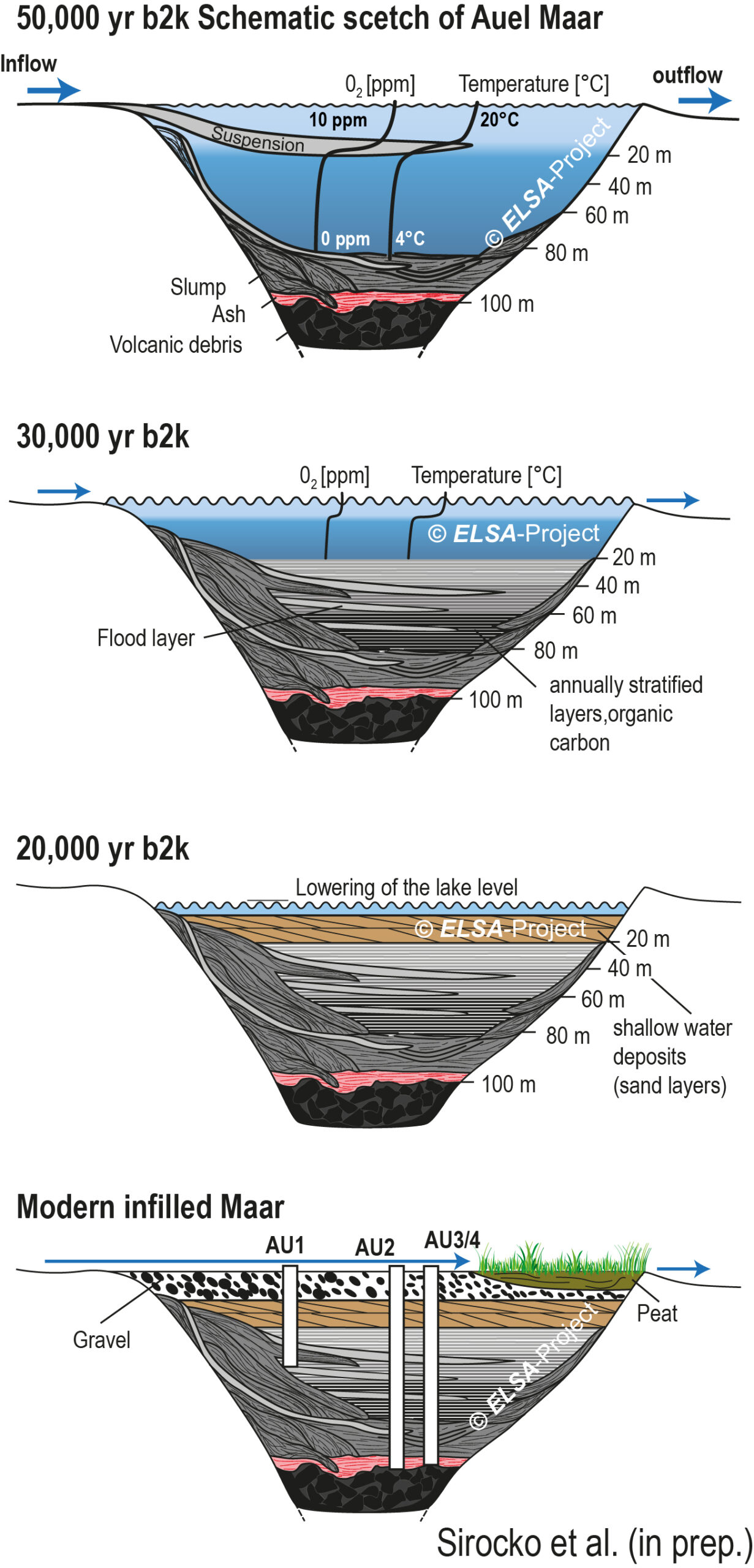
- Graphic schematic scetch of Auel Maar
- Figure Auel Maar
58 of the 68 known maar structures are old Pleistocene lakes, which have been filled up completely with sediment. These structures are today well visible in the landscape, often surrounded by a forested tuff wall and with grassland or swamps in the center. Some of these infilled maar lakes were fed with debris from soil erosion in the catchment, which is particularly large if a creek runs through the basin. We have choosen for the ELSA-20 only maar structures, which were indeed filled with fluvial runoff. This are a small creek draining the eastern Schalkenmehrener infilled maar, the Sammetbach that runs into Holzmaar, and the Tieferbach, which has a catchment of 5 km length and is still running through the infilled maar of Auel. The cores from Auel thus have the highest sedimentation rate of up to occasional extreme values of 5mm/year during cold and wet phases of MIS3. The sedimentation rate during the warmer interstadials are, in contrast, only at around 1 mm/yr. A disadvantage of Auel is the observations that the lake during peak glacial times had a lowered lake level by several meters. The lake waterdepth from 22,000 – 15,000 yr b2k was thus only a few meters, which implies that wave and currents could have disturb the sedimentation patterns.

The ELSA-20 uses the Auel sediment also for the last glacial maximum, but in addition we study the cores from nearby Dehner Maar, which has no creek inlet, and a very small catchment (Sirocko et al., 2016). This maar is thus infilled by eolian dust only, and we use it for specific work on the dust fraction. Römer et al. (2018) use it accordingly to determine the provenance of dust. The Dehner Maar record is counted for glacial varves at the moment and it will be used to study the annual resolution aridity history on an indeed varve counted annual basis.