Informations and Figures from this Webpage can be downloades and used. The ELSA Copyright must remain in the figures and the work is to be cited as:Sirocko, Frank (2024). The ELSA Project Webpage. https://elsa-project.de/
The ELSA project was started with the aim to infer the sediments of the Eifel maar lakes and dry maars as a Geo archive. This website presents the results to researchers, interested laypersons, and the general public. The data generated from the measurements as well as the main graphics are made accessible as downloadable files.
The ELSA Project was initiated by Frank Sirocko in 1998, shortly after he was appointed as Professor for Geoscience at the Johannes Gutenberg-University Mainz, which is located in Germany in the State of Rheinland-Pfalz. The most important, and at that time already well known geoarchive in this state were the 6 open maar lakes with Holocene sediment infill in the West Eifel Volcanic Field. The older, already infilled maar lakes, however, were not studied at all with any drillings up to that time. The challenge was to drill through many meters of young gravel into the underlying fine grained lake sediments and date their age.
- ELSA-20 (0 – 60.000 BP) -Corg Data
- ELSA-23 (0 – 130.000 BP) -Corg Data
- ELSA-20 (0 – 60.000 BP) -Pollen-Stack all pollen counts smoothed
- ELSA-20 (0 – 60.000 BP) -Pollen-Stack (< 20 counts) no pollen
- ELSA-23 (0 – 130.000 BP) -Pollen-Stack all pollen counts smoothed
- ELSA-23 (0 – 130.000 BP) -Pollen-Stack (< 20 counts) no pollen
- ELSA-20 (0 – 60.000 BP) Megafauna Data
- Central European Speleotheme Stack
- >> High resolution pollen on varve-counted time scale: to be published by the end of 2024 due to ongoing work on the varve counting
- ELSA-20 (0 – 60.000 BP) Graphics
- ELSA-23 (0 – 130.000 BP) Graphics
- Latest ELSA publications
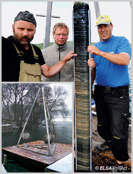
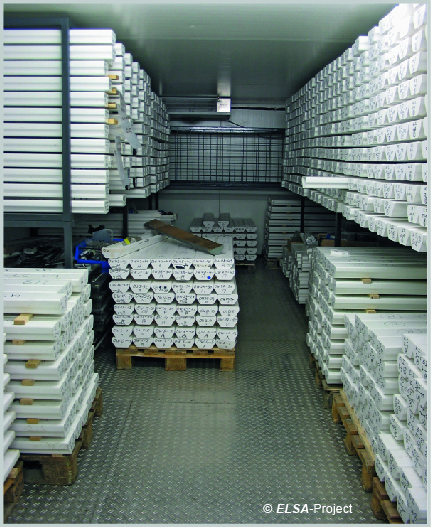
The first 20 drillings down to 10 m depth were done with a Rammkern system, the subsequent 50 drillings (see table under Core Locations) with a commercial Seilkern technique by the drilling company “Stölben Bohr”. All drillings were dated with 14C ages, which revealed that almost all infilled maar structures are from the last glacial cycle. 20 large maar structures were chosen for deep scientific drilling down to 100 m.
Dating techniques evolved with drilling experience and all long cores were completely dated 17 years after the initial drilling (Sirocko et al. 2016). About 20% of all drill cores from the Eifel maar reveal annual layers, called varves. Unfortunately, continuous varve formation is only observed in the Holocene and older interstadials, glacial sections and stadials are often only laminated; i.e. layered, but not with annual resolution. The countable annual sediment layer are the unique quality of the ELSA sediments.
The subsequent years explored the possibility of annual layer (varve) counting and systematic core to core correlations with pollen and tephra analysis. The pollen represent the vegetation around the maar and allow to determine the history of the landscape, well reproducible from one site to the other. Tephra layers from the Eifel volcanism lead to distinct cm thick layers, which can be correlated between cores, but in several cases also to the site of eruption, which in some cases provided another source of stratigraphic information. Volcanic eruptions and regional vegetation change showed a consistent pattern, which resulted in the definition of Landscape Evolution Zone, which Sirocko et al. (2016) used to determine environmentally uniform phases during the last 60.000 years.
The four best dated sediment cores from the maar lakes of Schalkenmehren und Holzmaar were combined with the longest records from older infilled maar lakes of Dehner and Auel; all of which combined to a continuous time series of annual resolution, which cover the last 60.000 years continuously, the so called ELSA-20 record. This record can be downloaded directly from this website, the NATURE-GEOSCIENCE and the PANGAE websites.
It is the intention of this website to present all ELSA proxy records, which have been analysed during the last two decades on the new ELSA-20 chronology. This chronology is within 150 years comparable to the annual layer counted Greenland ice core chronology of Rasmussen et al (2014); thus, ELSA-20 provides the unique possibility to synchronize the climate and environment of central Europe precisely with the global ice core chronologies.
Freeze-Core Drilling
“Rammkern”-Drilling
References, nomenclature and data download
This ELSA Project website presents the background information for all ELSA cores. It now concentrates on the ELSA-20 record, but will finally present the core photos and data for alle ELSA data produced during the last 20 years. References are made only to published peer reviewed scientific papers of the ELSA Project itself. Some figures are taken from published papers, but reduced to basic findings, others use the original proxy data, but all time series plot on the new ELSA-20 stratigraphy. More detailed scientific information is accessible from the referenced papers directly; see a list of all peer reviewed ELSA papers at the end of this text. Respective data can be directly downloaded from the home page of this website, all figures shown can be downloaded in Powerpoint format. All ages of this text and figures are presented as “yr b2k” (years before the year 2000), which is the official nomenclature of the Greenland ice core GICC05 chronology, or “BP” (before present). The text includes several other stratigraphic abbreviations, which are “MIS” for “Marine Isotope Stage”, “GI” for “Greenland interstadial”, “LGM” for Last Glacial Maximum.


